Layouts
& Plotting
Turning one piece of land into sanctioned, sellable plots. What people still call an “NA layout” is simply a sanctioned layout now — the rules changed, the work did not. We design the plots, internal roads, open space and amenity area, and prepare drawings the authority will actually sanction.
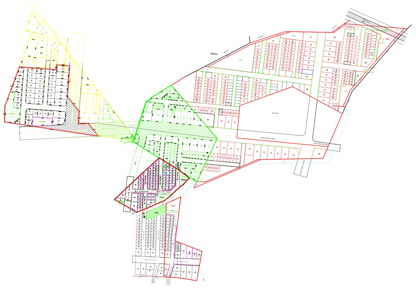
What layout and plotting work includes
The design decisions that determine how many plots you get — and whether the file clears scrutiny.
- Layout design — plot sizes, frontages, internal roads and open space
- Recreational open space and amenity space worked in as the rules require
- Net plot area computed after road and amenity deductions
- Land-use and reservation position checked before you spend anything
- Area statement and plot table prepared to authority format
- Dues, deposits and likely costs laid out up front
Plot yield
Road widths, frontage depth and open-space placement decide how much sellable area survives. This is design work, not drafting.
Reservations
A DP road or a reservation across the parcel changes everything. Better found in week one than in the scrutiny remarks.
A file that clears
Drawings prepared to the format the department expects move faster and come back with fewer remarks.
Four steps, no surprises.
Survey & records
Measurement survey and a full check of the land-use and reservation position.
Design options
Plotting alternatives compared on yield, frontage and road layout.
Drawing set
Layout drawing, area statement and plot table prepared for submission.
Sanction & ground
Approval carried through, then centre lines and plot corners marked on site.
Layout design and plotting — asked and answered.
Is “NA 44” still the right term?
People still ask for NA 44, and we know exactly what they mean. The procedure has changed — a sanctioned layout under the current development control rules replaces the old NA order route in most cases — but the practical work of designing plots and getting them approved is the same. We will tell you which route your parcel actually falls under.
How much land is lost to roads and open space?
It depends on the parcel shape, the road widths required and the size of the holding. Internal roads, recreational open space and amenity space all come off the gross area; a well-designed layout minimises that loss without risking the sanction. We show you the net plot area before you commit.
What is the smallest parcel worth plotting?
We have plotted parcels from a couple of acres up to twenty. Below that, road and open-space requirements start eating the yield, and in some cases a straight sale or a different route makes more sense — we will say so.
Can you handle survey, layout and approval together?
That is how most of our layout work runs — one team from the first measurement through the sanctioned drawing and the poles on the ground. See the 20-acre Georai layout for the whole sequence on one parcel.
Areas we survey
Every service is a step in the same journey.
Turn your land into sanctioned plots.
Send us the Gut or Survey number and what you need — we'll tell you the scope, the cost and the time it takes.