Marking the
ground truth.
For three decades, Landmark Surveys has measured, marked and unlocked land — from a single plot boundary to fully sanctioned layouts. Rooted in Chhatrapati Sambhajinagar, trusted by clients across India.

Disha Group

Badwe Engineering

Garware Hi-Tech Films

Cherry Corporation

Prozone
From first measurement
to final sanction.
Five connected services that take land from raw measurement to a legally usable, plotted and approved layout.
Measurement Survey
Precise area & dimension capture using total stations, reconciled against 7/12 and revenue records.
→ 02Centre Line
Accurate centre-line marking for roads, plot rows and structures — the backbone every layout is built around.
→ 03Boundary Marking & Fixing
On-ground demarcation and permanent fixing of RCC boundary poles — clean lines that settle disputes for good.
→ 04Layouts & Plotting
Raw land turned into sanctioned, sellable plots — plotting designed to pass scrutiny.
→ 05Planning & Approval
Layout design and liaison with Town Planning, the Collectorate and local bodies through to final sanction.
→ — · —See the full
scope of work
→
Three decades of standing on the land, reading the records, and drawing the line exactly where it belongs.
The practice began in 1992, and Dinesh Patil carried it into Landmark Surveys when he founded the firm in 2008 — on a simple promise: get the measurement right, document it properly, and the approvals will follow. Generations of landowners, builders and architects have trusted us to convert that promise into clear title and sanctioned plots.
A measured path from enquiry to handover.
Enquiry
Share your plot, survey number and what you need. We assess scope and revenue records.
Site Survey
Our team visits and captures precise measurements with total-station equipment.
Drawing & Layout
We prepare measurement plans, centre lines and the layout to authority standards.
Approval
We compile the file and liaise with Town Planning and the Collectorate for sanction.
Handover
RCC boundary poles fixed on ground, sanctioned plans in hand — your land, ready to use.
Layouts, sites & surveys on the ground.
Land turned into a school for a private developer — NA layout, planning and approvals carried through.
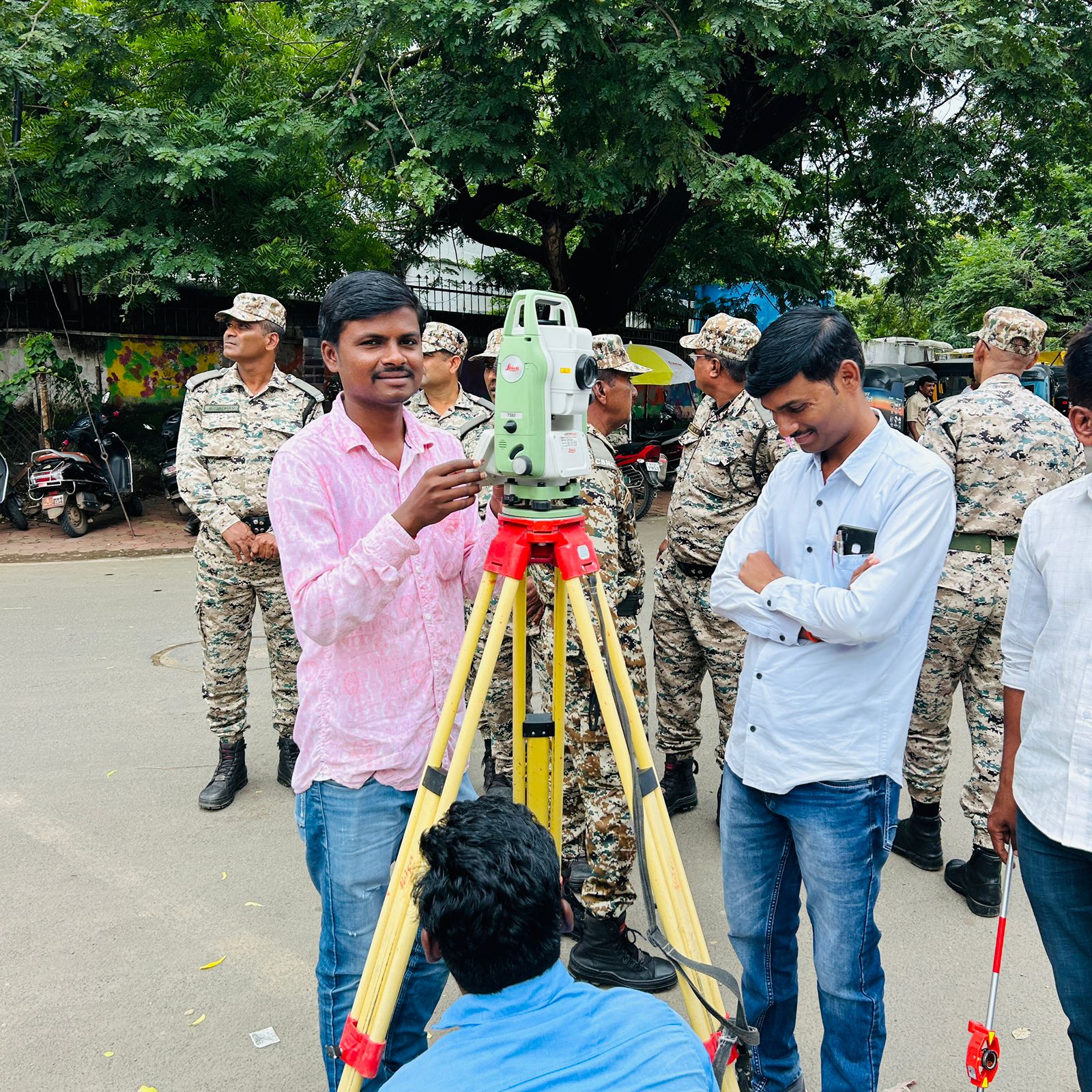
Total station survey and centre-line marking of 20+ DP corridors for the Municipal Corporation's town planning department.
Twenty acres of raw agricultural land taken from first survey to sanctioned layout — plots, internal roads and open space.
Let's get your land measured, marked and approved.
Tell us the survey number and what you'd like to do — we'll guide you through the rest.